-
Home

-
faq 2 test

- GC606
GC 606: The Wildest Drive In Gran Canaria
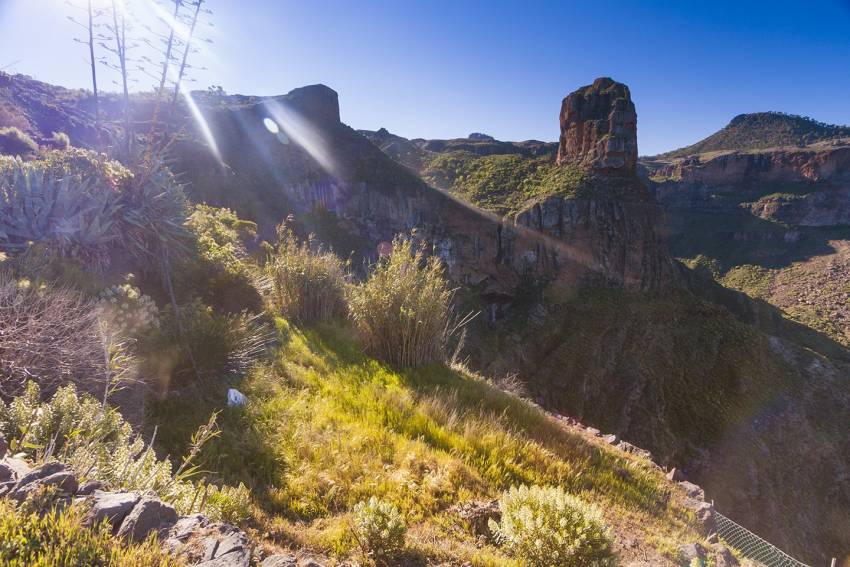
Gran Canaria's least-driven road takes you to white villages surrounded by palm and almond trees and past Roque Palmés: Little brother to Roque Nublo.
The GC-606 road is only 12 kilometres long according to Google Maps but takes a good hour and a half to drive as it is barely wide enough for a car and long stretches are barrier-less. It's spectacular or terrifying, depending on how you handle heights.
Starting as a fork on the GC-60 between Tejeda and San Bartolomé (Tunte) it winds downhill to the tiny hamlets of El Toscón and Carrizal de Tejeda before linking to the GC 210 that links Tamadaba with La Aldea. Between the two is a viewpoint overlooking Roque Palmés.
The lower half of the road is the scariest as there's nothing between you and the Barranco bottom hundreds of metres below. Stop for great views back towards the Tamadaba massif and the Presa de Parralillo reservoir in the valley.
This pie slice of the island tucks into a fold and is hidden from the main Cumbre roads. That and the fact that it links up to another crazy road: The GC 210 between Artenara and La Aldea, make it Gran Canaria's least driven tarmac route.
For an idea of just how wild and rugged west Gran Canaria is we recommend it: Just takes things slowly and use the horn on the blind bends.
Gran Canaria Info recommends:
- Default
- Title
- Date
- Random
Join the Gran Canaria Info newsletter list
Gran Canaria info recommends
-

Gran Canaria Shopping: Start At Fundgrube For Price & Quality
-

Hassle-Free Gran Canaria Car Hire
-

Which Gran Canaria Airport Transfer Service Is The Best?
-

The Best Value Car Rental Service In Gran Canaria
-

Off The Beaten Track With A Gran Canaria Buggy Trip
-

Casa Romantica: A Classic Gran Canaria Restaurant Reborn
- 1
Follow us on Facebook
Tip of the day
Latest articles
Who's Online
We have 4819 guests and no members online


